
Over 10,000 Evacuated as Sankosh River Faces Flood Threat
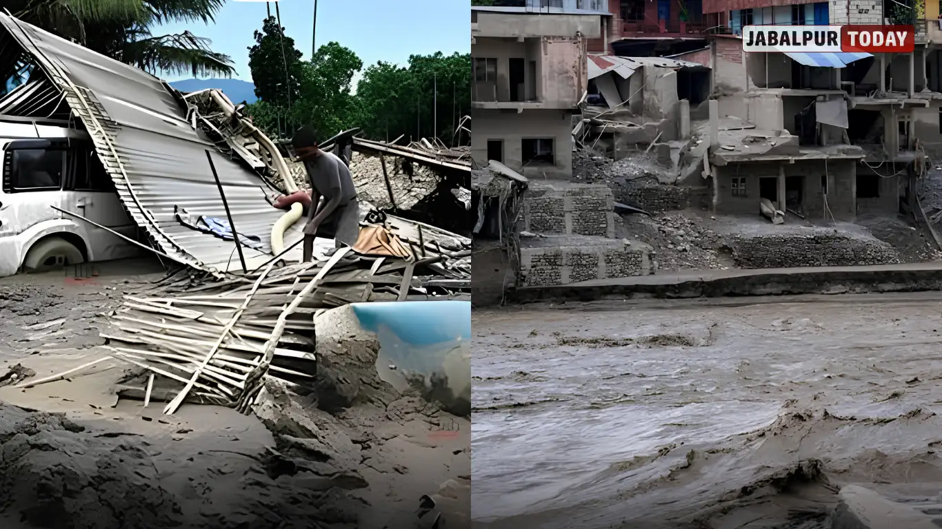
THIMPHU/SILIGURI: A glacial lake outburst flood (GLOF) from Shintaphu Lake (also known as Sintaphu or Shintaphu Tsho) in northern Bhutan late on Thursday evening sent a massive wave of water and debris rushing down the Mo Chhu river system. The sudden flood damaged infrastructure in Bhutan and prompted authorities to issue high-alert warnings across five districts in West Bengal and Assam.
By Friday morning, authorities had moved more than 10,000 people in West Bengal’s Alipurduar district to safer locations or temporary shelters. Officials prepared for a possible sudden rise in the Sankosh River, which is the Indian name for the lower stretch of Bhutan’s Punatsangchhu River. Authorities had reported no deaths or injuries on either side of the border so far.
The incident highlights the growing danger of climate-related glacial disasters in the Eastern Himalayas. Rising temperatures are speeding up glacier melting and increasing the size of high-altitude lakes. These lakes can suddenly release huge amounts of water, often with very little warning.
What Happened at Shintaphu Lake?
On the evening of 29 October 2026, the natural barrier holding Shintaphu Lake collapsed. The lake lies below Wakila Mountain in Lungo, Laya Gewog, in Bhutan’s Gasa district. It sits at the source of the Mo Chhu River in the Mochu sub-basin. Bhutan officially lists it among its 17 potentially dangerous glacial lakes.
Initial reports estimated that the lake released around 7.4 million cubic metres of water in a sudden surge. Floodwaters reached Taktsemakhang between 8:15 pm and 8:27 pm local time. The water then continued downstream through the Mo Chhu and into the larger Punatsangchhu river basin.
By Friday morning, the flood had crossed Srigang in Kabesa Gewog, around eight kilometres from the historic Punakha Dzong.
Bhutan’s National Centre for Hydrology and Meteorology (NCHM) immediately activated sirens along the Mo Chhu and downstream Punatsangchhu rivers. Officials monitored water levels at stations such as Tashithang and Yebesa and informed Indian authorities about the situation.
The flood also cut off the remote Laya region after water and debris washed away or blocked sections of the Laya Dzongkhag Road and the Punakha-Gasa Highway.
Damage in Bhutan: Hot Springs, Bridges, Solar Project and Roads
The sudden flood completely destroyed facilities at Gasa Tshachu, a popular natural hot-springs tourist destination located along the Mo Chhu River. A similar flood had also damaged the site on 26 August 2021.
Authorities fear that the flood may have washed away two Bailey bridges, which are portable, pre-fabricated structures used to provide temporary road connections.
The flood also partially damaged a solar-powered irrigation project in Dochhukha-Dzomlingthang-Ritsa Chiwog under Guma Gewog in Punakha. The damage stopped the project from functioning. Flood debris also blocked a section of the highway and further isolated nearby communities.
The disaster affected hydropower operations in the river basin. One report stated that officials emptied the PHPA-II reservoir and opened its sluice gates as a precaution.
However, officials have not completed the full damage assessment because darkness, strong water currents and the area’s remote location have made inspection difficult.
How Will the Flood Travel From Bhutan to India?
The Mo Chhu and Pho Chhu rivers meet near Punakha in Bhutan and form the Puna Tsang Chhu, also known as the Punatsangchhu.
After flowing through Bhutan, the river system enters India as the Sankosh River. People also know it as the Gangadhar in some parts of Assam.
The river forms part of the boundary between West Bengal and Assam before joining the Brahmaputra near Gauripur in Assam’s Dhubri district.
When a glacial lake suddenly releases a large volume of water, ice, rocks and sediment in the mountains, the flood can travel dozens of kilometres within a few hours. It can also cause river levels to rise rapidly in the plains.
Initial Indian advisories estimated that the flood surge could reach the India-Bhutan border within six to eight hours of the lake’s collapse.
West Bengal and Assam on High Alert: Five Districts Face Flood Threat
Authorities in West Bengal placed Alipurduar, Cooch Behar, Jalpaiguri and parts of the Darjeeling hills on high alert.
Officials issued specific warnings to communities living near the Sankosh River, including residents of Kumargram, Chengmari, Pakriguri, Bholka/Valka Barabisa, Jharaguri, Upper Sankosh Forest Village, NKC Sankosh Tea Garden, Tufanganj and Boxirhat.
In Assam, Dhubri remains the main area of concern. Authorities have also extended river monitoring to Kokrajhar, Baksa and Chirang. Officials asked people living near the Brahmaputra river system to remain alert and follow safety instructions.
West Bengal Forest and Environment Minister Manoj Kumar Oraon, who also represents Kumargram as an MLA, released urgent video appeals late Thursday night. He urged people living in forest villages and tea estates to move to higher ground.
Union Minister Nisith Pramanik and local administrative officials also asked residents to leave low-lying riverbeds and tea-garden areas immediately.
More Than 10,000 People Moved to Safety: Emergency Response Underway
By Friday morning, Alipurduar Superintendent of Police Amit Kumar Shaw reported that authorities had moved more than 10,000 people to safer locations.
Around 4,000 to 5,000 people had taken shelter in school buildings that officials converted into temporary relief centres. Authorities had also shifted more than 6,000 people to safer places as a precaution.
The State Disaster Management Authority activated its control rooms and deployed National Disaster Response Force (NDRF) and State Disaster Response Force (SDRF) teams, including in Tufanganj and Boxirhat.
Civil Defence volunteers supported the relief operations. Authorities arranged dry food, drinking water and medical facilities for people staying in relief shelters.
Indian officials also maintained continuous communication with their Bhutanese counterparts to monitor the situation and receive updates.
Reports suggested that the intensity of the water flow had decreased slightly by Friday morning. However, authorities continued to monitor river levels because the flood threat had not completely passed.
Why Are Glacial Lake Outburst Floods Increasing? Understanding the Role of Climate Change
A glacial lake outburst flood, commonly known as a GLOF, occurs when the natural barrier holding a glacial lake breaks or collapses. This barrier may consist of ice, loose rocks and soil called moraine, or bedrock.
When the barrier gives way, the lake releases a sudden and powerful flow of water, ice, rocks and sediment.
Several natural events can trigger a GLOF. These include:
- Ice avalanches falling into a lake.
- Rockfalls from nearby mountains.
- Heavy rainfall.
- Earthquakes.
- Continuous glacier melting that weakens the natural barrier.
Climate change remains a major reason behind the increasing threat of these floods. Temperatures in the Himalayas have risen faster than the global average, causing glaciers to melt and retreat more quickly.
As glaciers shrink, they leave behind lakes that can continue to grow in size. Bhutan alone has hundreds of glacial lakes, and authorities have classified 17 of them as potentially dangerous.
Across the Hindu Kush Himalaya region, recorded GLOF events have increased sharply over recent decades.
The Eastern Himalayas, which include Bhutan, Sikkim and parts of Arunachal Pradesh and Assam, face a particularly high risk. Steep mountain slopes, rapidly growing glacial lakes and large populations living downstream increase the danger.
The 2023 South Lhonak glacial lake outburst flood in Sikkim also showed how destructive these events can become.
Cross-Border Flood Threat: Why India and Bhutan Need Better Early Warning Systems
Rivers that originate in Bhutan and flow into India make glacial lake floods a shared challenge for both countries.
Bhutan’s NCHM monitoring stations and siren systems, along with quick information-sharing between the two countries, helped limit the loss of life during this incident. Indian authorities also responded quickly and began large-scale relief operations.
However, the incident has highlighted some gaps in the existing warning systems.
Reports suggest that one monitoring station near the lake did not generate an automatic alert when the flood first began. Authorities also need to improve real-time flood modelling across the India-Bhutan border to predict how water levels may change as the surge moves downstream.
Experts have stressed the need for several long-term safety measures, including:
- Expanding satellite monitoring of dangerous glacial lakes.
- Installing more ground-based monitoring sensors.
- Developing joint early-warning systems between India and Bhutan.
- Keeping emergency supplies and rescue equipment ready in high-risk areas.
- Conducting awareness programmes in vulnerable tea-garden and forest villages.
- Improving communication between local communities and disaster management authorities.
Authorities can also reduce the risk by carefully lowering water levels in highly dangerous glacial lakes. Bhutan has used this method at some lakes in the past.
Latest Situation: What Should Residents Do?
As of Friday morning, 30 October, authorities continued to monitor water levels in rivers downstream from Bhutan. Although the intensity of the flood had eased slightly, officials warned that more water surges and debris flows could still occur.
Residents of the affected districts, particularly those living near the Sankosh River and its tributaries, should follow these safety instructions:
- Follow official updates: Stay informed through state and district disaster management authorities.
- Avoid rivers: Stay away from riverbeds, low-lying bridges and tea-garden areas close to the water.
- Keep emergency supplies ready: Prepare essential medicines, drinking water, food, important documents and other emergency items.
- Help vulnerable people: Check on elderly residents, children and people who may need assistance.
- Follow rescue teams: Pay attention to instructions from local administration, police, NDRF and SDRF personnel.
What Happens Next? The Growing Flood Risk in the Himalayas
The Shintaphu Lake disaster is another warning about the changing conditions in the Himalayas. Events that once occurred rarely are becoming a greater concern as global temperatures rise and glaciers continue to melt.
For thousands of people living along the Sankosh River corridor in Alipurduar, Cooch Behar, Dhubri and neighbouring areas, timely warnings and proper preparation can make the difference between safety and disaster.
So far, Indian and Bhutanese authorities have reported no loss of life. However, both countries will need continuous monitoring, stronger cross-border cooperation and greater investment in early-warning technology to maintain this safety record.
The water that rushed out of Shintaphu Lake on Thursday night has already caused damage in Bhutan’s mountainous areas. The next major concern is how the river system will handle the flood surge as it moves towards the Indian plains and how effectively authorities can protect communities living along its banks.
Residents should follow the latest official announcements from the West Bengal and Assam disaster management authorities, district administrations and the National Disaster Response Force for further updates.
